HROUS
Slope Stability Assessment in Ontario: Requirements for Owners
Compare slope stability assessment proposals by separating local submission requirements from investigations and follow-up work triggered by site conditions. Hamilton’s Development Application Guidelines and Ottawa’s Slope Stability Study Terms of Reference set different municipal requirements—not an Ontario-wide scope. [1][2]

- Required when applicable: the qualified engineer, assessment, report and submission files specified by the reviewing municipality. [1][2]
- Site-dependent: supplemental surveying, subsurface investigation, testing and modelling selected through Hamilton’s inspection and rating process. [1]
- Conditional in Ottawa: peer review and, in certain settings, assessment of large-scale retrogressive-landslide risk. [2]
1. Match the proposal to the municipality and application stage
Start with the proposed development, application stage and reviewing authorities. The two municipalities identify different submission triggers:
- Hamilton: A study may be required for a Zoning By-law Amendment, Draft Plan of Subdivision, Site Plan Control or Consent to Sever. [1]
- Ottawa: Where potential hazard lands exist, a report is required before approval of Site Plans, Draft Plans of Subdivision, Severances, Condominiums and Building Permits. Depending on the concern, assessment may be required earlier, for an Official Plan Amendment or rezoning. [2]
In Hamilton, review involves City Development Planning, Development Approvals and the Conservation Authority regulating the land. Hamilton encourages discussion with City staff and that Conservation Authority before completion of fieldwork; it does not make this discussion an expressly mandatory step. [1] In Ottawa, obtain location-specific direction from the development-review contact assigned to the site’s ward. [2]
Ask each proposal to name the responsible engineer and describe their relevant experience. Hamilton’s principal guideline requires an Ontario Professional Engineer to prepare, stamp and seal the study, with geotechnical-engineering experience expected. [1] Hamilton’s July 2023 checklist uses different wording—“Professional Engineer or Geoscientist”—which the principal guideline does not reconcile. Do not assume this permits geoscientist-only sign-off. [1] Ottawa requires an Ontario-licensed geotechnical engineer qualified through professional experience to provide geotechnical-engineering services to prepare the Slope Stability Study report. [2]
Put the development description, application stage, reviewing bodies, governing municipal documents and responsible professional at the top of the proposal comparison. [1][2]
2. Separate surveyed geometry from engineering conclusions
A surveyed top of bank locates a physical feature; it does not, by itself, establish a safe development setback. Ottawa describes the study’s purpose as assessing stability and, where necessary, establishing a safe setback behind the crest. [2]
Use Hamilton’s requirements to separate the scope into two parts:
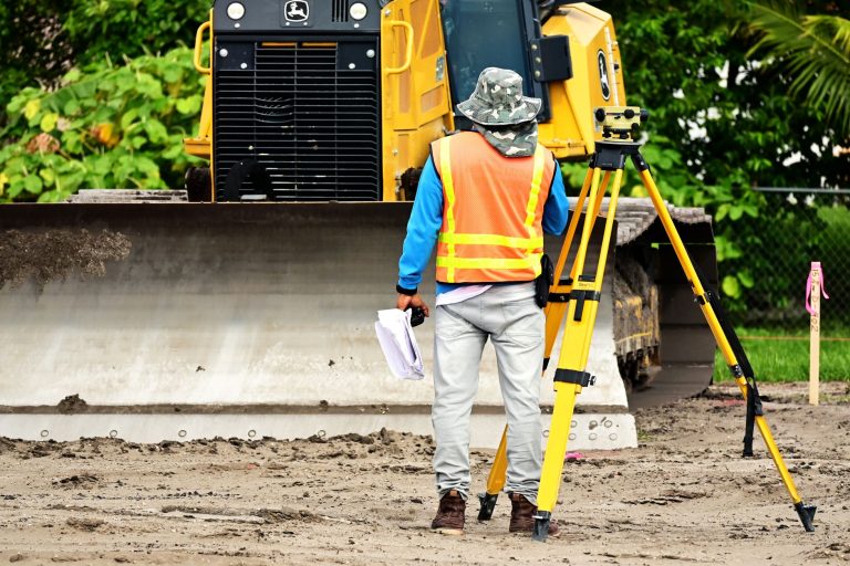
- Geometry inputs: a detailed topographic survey, identified horizontal and vertical datums, staking or flagging of the slope’s top and toe, and slope cross-sections. [1]
- Engineering outputs: stability conclusions, applicable allowances, the development setback and a detailed setback plan. Hamilton addresses toe-erosion, stable-slope, access and wave-uprush allowances where relevant. [1]
Ask each consultant:
- Who supplies the survey, datums, top-and-toe staking or flagging, and cross-sections?
- Does the proposal assume an existing survey is adequate, and who checks that assumption?
- If geometry information is missing, is obtaining it included or excluded?
- Does the scope include the engineering interpretation and resulting setback drawing, rather than survey inputs alone?
The proposal should make the hand-off between measured information and engineering interpretation explicit. Hamilton’s survey-related items and its stability and setback conclusions are distinct parts of the assessment. [1]
3. Compare site-investigation assumptions
Compare the proposed investigation before comparing total fees. Hamilton’s checklist asks whether the quantity and depth of investigation are adequate for the development and whether further work is anticipated. [1]
Keep the initial inspection separate from subsequent investigation. Hamilton requires the inspection and slope-stability rating to follow the Ministry of Natural Resources’ older Technical Guide – River and Stream Systems: Erosion Hazard Limit 2002. The resulting rating determines the investigation level under that guide. [1]
Use the same comparison fields for each proposal:
- Investigation layout: proposed numbers, locations and depths of boreholes, test pits and monitoring wells, with an explanation of their adequacy for the development. Distinguish proposed work from any existing investigation results; the completed fieldwork details belong in the report. [1]
- Timing and existing information: anticipated fieldwork timing and relevant previous investigations to be used. Hamilton expects fieldwork dates and discussion of available prior investigations in the report. [1]
- Bedrock evidence: whether drilling includes coring to confirm bedrock or will infer bedrock from auger refusal. Hamilton distinguishes these forms of evidence. [1]
- Groundwater: whether monitoring wells are included and how groundwater depth and conditions will be characterised, including whether groundwater is perched, confined, unconfined or artesian. [1]
- Testing: included laboratory tests, such as moisture content, grain-size distribution, Atterberg limits, Proctor analyses or bedrock compressive strength, and their relevance to the project. [1]
- Investigation limits: findings that could require additional investigation, whether further work is anticipated, and whether it is included or needs separate authorisation. [1]
Do not treat every listed method as a mandatory package. Hamilton presents drilling, coring, wells, test pits, infiltration testing and laboratory methods as possible activities. Compare their justification against the site and proposed development rather than counting inclusions. [1]
4. Check what the engineering analysis will decide
A scope promising “slope modelling” should explain which development decisions the analysis will support. Hamilton connects the analysis to stable slope inclination, development setbacks and relevant allowances. [1]
- Development limits: Does the scope determine stable slope inclination and the development setback? Hamilton’s checklist asks whether each relevant allowance applies, its amount and the justification. [1]
- Safety target: Does the report identify the target Factor of Safety and justify its selection for the proposed development? Hamilton’s guideline does not provide a universal numerical target or setback. [1]
- Supporting analysis: Which cross-sections, subsurface information and modelling assumptions support the conclusions? How will assumptions or unresolved conditions be identified? Hamilton includes cross-sections and computer modelling among its slope-assessment items. [1]
The recommendations should address the development proposed. Hamilton calls for design and construction advice relevant to encountered conditions, including foundations, grading, excavation, dewatering and retaining walls where required. [1]
5. Confirm the report, drawings and electronic files
Have the proposal list deliverables rather than promise only a “geotechnical report.” Hamilton and Ottawa specify different submission requirements. [1][2]
Hamilton: report and drawing checklist
- Report identification: preliminary or final status, site address, owner, project description, land use, preparation date and clear property identification. [1]
- Site plan: property limits, proposed construction and investigation locations. [1]
- Review record: governing policies, relevant previous studies, consultation results, and checklist page or section references showing where requirements are addressed. [1]
- Slope documentation: inspection record, rating chart and rating, supplemental-work level, survey and top-and-toe staking status, investigation and laboratory information, cross-sections and modelling. [1]
- Engineering conclusions: the target safety factor and justification, applicable allowances and setbacks with amounts and reasons, and a detailed setback plan. [1]
- Coordination files: where a development setback limit is required, it must be supplied in geodetic CAD and ArcGIS formats for overlay on other disciplines’ plans. [1]
Hamilton warns that omitted checklist requirements make the investigation incomplete. The City’s use of the checklist does not verify the report’s engineering content: completeness and technical adequacy are separate matters. [1]
Ottawa: required and conditional files
- Required: studies and plans supplied electronically as unlocked, flattened Adobe PDF files. [2]
- May be requested: supporting georeferenced CAD/BIM/GIS files meeting Ottawa’s submission standards. [2]
For report contents, have the proposal address Ottawa’s Slope Stability Guidelines and referenced minimum-requirements checklist—not Hamilton’s list. [2]
6. Identify conditional work and review follow-up
Separate excluded work from work allowed for only if site findings or municipal review trigger it:
- Hamilton—inspection and rating: The rating determines the required supplemental investigation. Ask how the proposal handles additional survey, subsurface investigation, testing or modelling identified at that stage. [1]
- Ottawa—retrogressive-landslide risk: In sensitive marine-clay areas where there are deep valleys or embankments, Ottawa may require assessment of large-scale retrogressive landslides and delineation of the hazard’s extent. This is not a universal requirement for every slope site. [2]
- Ottawa—review: The City evaluates reports against its municipal Slope Stability Guidelines and may require peer review. [2] Ask whether responding to comments, revising drawings and supplying additional information are included, and how limits on that work are defined.
For each conditional task, record the trigger, deliverable, responsible party, inclusion or exclusion, and point at which further authorisation is needed. This is a proposal-comparison tool, not a municipal form.
Ottawa requires slope-stability assessment reports before approval where potential Hazard Lands exist; Hamilton’s cited guidelines do not publish submission deadlines. Neither city’s cited document publishes application or study-review fees, processing times, approval-expiry periods or renewal duties. [1][2]
7. Resolve scope gaps before authorising work
Mark each item included, conditional, excluded or not explained. Record the promised deliverable and assumptions beside it, then obtain written clarification of unexplained items.
Pause over these warning signs:
- A generic “Ontario scope” that ignores differing municipal requirements. [1][2]
- “Confirmed bedrock” supported only by auger refusal, which Hamilton distinguishes from confirmation by coring. [1]
- A report-only offer that does not identify applicable drawings or electronic-file deliverables. [1][2]
Compare what each consultant commits to supplying, what depends on initial findings, and what remains outside the quoted scope. Use the checklist to compare commitments—not to validate the engineering.
References
- DEVELOPMENT APPLICATION GUIDELINES (hamilton.ca, 2026)
- Slope Stability Study (ottawa.ca)